Monday 19 September 2016

Passage planning from Vuda Marina to Luganville

Customs officials charge extra to work over weekends.

We want to get to Vanuatu as soon as reasonably possible, to avoid getting too late in the season and getting unpleasant weather on the way home to Australia.

We fly in to Nadi, Fiji, on Fiji Airways (FJ 920) Friday 21st October
11:30 AM Brisbane Brisbane (BNE), terminal I. Eta 05:00 PM Nadi Nadi International (NAN)

Provisioning and odd-jobs will be done over the weekend
  • Fit capacitor to genset.
  • Install seawater pump.
  • Pay Ali
  • Webbing on mainsail
Clearing out of Vuda Marina is significantly cheaper than Denarau.

What is the best time to leave, without incurring extra charges with check-out customs in Vuda, or check-in customs at Luganville?


The implication of these times is that it would be batter to check out of Vuda on Wednesday, spend the night in Momi Bay, and then sail to Luganville on Thursday. The earlier departure would involve rushing, and assumptions about speed which might not be met.


Below is the Bundy Rhum route recommended by the Port2Port Yacht rally. It goes north of both the NewCal northern reefs as well as the Chesterfield Reefs.


Sunday 18 September 2016

Fiji to Vanuatu

Departing Fiji

Customs On Departure

Within 24 hours of your planned departure from Fijian waters, you should proceed to the Customs office on the main wharf and complete Customs Clearance formalities. You will need your inbound clearance papers, crew details, the details of your vessel and next port of call. You are required to sail from these waters within 24 hours. If you are delayed beyond this time, contact the same Customs people immediately. Customs must be cleared before Immigration, and Customs will not clear you unless all Port dues and Health fees are paid.


Yacht Customs Clearance Vanuatu Ports of Entry
These instructions are adapted from the Government of the Republic of Vanuatu Customs and Inland Revenue Department Notice to Masters of Visiting Yachts and Small Craft.
We strongly recommend you go to the official Customs Website to get the very latest information and forms for clearance and cruising in Vanuatu:

Yacht Fined for Violating new customs regulations

NOTE: Yachts wanting to stop in New Caledonia's Loyalty Islands

If you plan to voyage between Vanuatu and New Caledonia and want to stop in the Loyalty Islands, check with Chloe at Noumea Ocean Yacht Agent to find out if she can arrange clearance for your yacht in the Lifou or Ouvea.

Cruising Yacht Entry Forms

You may download and complete these PDF files prior to arrival to facilitate clearance. (or the clearance officer will provide the forms when you arrive). According to the Customs website if you fill out the required forms and email them to CustomsBorder@vanuatu.gov.vu along with the advance notice of arrival - prior to arriving - it will facilitate clearance.
Crew arriving by air plane authorization form (for details on crew arriving or departing by plane CLICK HERE.)

24hr Advance Notice of Arrival now required for entry into Vanuatu

Any vessel intending to visit Vanuatu must email customs at least 24 hours in advance giving the expected arrival time of the vessel, the last port of clearance, the names of crew and passengers on board and the port at which the yacht will arrive. If you are clearing into Port Vila you may provide the information to Customs on VHF channel 16.
Send the email to CustomsBorder@vanuatu.gov.vu (distributed to all 4 ports). According to the Customs website if you fill out the required forms (above) and email them two working days prior to arriving it will facilitate clearance.

Quarantine Flag

Vessels must put up the quarantine flag when entering Vanuatu's Exclusive Economic Zone (200 nm offshore of any Vanuatu Island and to leave it up until they are completely cleared in by both Customs and Quarantine

Customs Ports

There are four ports of entry into Vanuatu,
  1. Port Vila on the island of Efate,
  2. Luganville on Santo,
  3. Sola on Vanua Lava, and
  4. Lenakel on Tanna.
Yachts may not stop at any other island or anchorage in Vanuatu until first clearing in one of these four ports of entry. Note. This definitely means you are not allowed to enter in Port Resolution in Tanna or Aneityum (Anatom). Do not stop there without first getting permission by email as penalties are severe.
Yachts wishing to enter in any other port must first obtain written permission of the Director of Customs. If Customs has to clear a vessel in an undeclared port, the Captain will have to meet all costs (in Cash, Vatu) for the Customs Officer to be present at the undeclared port for clearance.
Again, this is not possible without written permission from the Director of Customs prior to the vessel arriving in Vanuatu waters. If you wish to enter in an undeclared port, such as Port Resolution of Aneityum, send the request for permission to clear into an undeclared port with your email advance notice of arrival and documentation forms. Be sure to give several working days for Customs to respond.

Enter or Depart from Tanna

Many yachts wish to enter in Tanna so they can visit Tanna, Aneityum and Erromango without having to beat to windward from Efate. Clearing in Tanna can be difficult. The anchorage at Lenakel on Tanna is small and subject to heavy swell during winds from the Northwest through the west to southeast making landing difficult. So be cautious on approach and anchoring.
Yachts may NOT clear in at Port Resolution without prior written permission from the Director of Customs.
Customs’ normal operating hours are 0730 – 1200 and 1300 – 1630 Monday to Friday.
There is no Customs charge during normal working hours.
Between 06:00 - 07:30 and 16:30 - 18:00 Monday to Friday there is a fee of VT 1,000 per hour per officer.
From 1800 to 0600 the fee is VT 1,500 per hour per officer and on weekends and public holidays VT 2,000 per officer.
A minimum charge of 3 hours is applicable for all out of normal hours attendances.
Note that the officers require cash - Vatu, Australian, American, New Zealand dollars - they do not take credit cards, travellers cheques or personal cheques. Also, the bank in Lenakel does not accept credit cards.

Port Vila and Luganville Ports of Entry

Port Vila and Luganville are the main ports of clearance and most yachts clear into Port Vila.
Days and Times to obtain clearance
The international and inter-island outward clearance will be granted only on Monday to Friday from 07:30 to 12:00 hours and 13:00 to 16:30 hours.
Clearance between 06:00 - 07:30 and 16:30 - 18:00 Monday to Friday requires a fee of VT 1,000 per hour per officer.
From 1800 to 0600 the fee is VT 1,500 per hour per officer and on weekends and public holidays VT 2,000 per officer.
A minimum charge of 3 hours is applicable for all clearances outside of normal hours.
Arrival
When you arrive in Port Vila anchor in the quarantine zone near the yellow buoy. This is just north of the lead markers in some 8 to 20 meters depth. You must have your yellow quarantine flag flying. Call Port Vila Harbour Control on Channel 16. They keep radio watch from 7:30 to 16:30. If they do not answer, try Yachting World on Channel 16. They will contact Customs and Quarantine for you. These officials will arrive with their own skiff (or with the Yachting World skiff).
Government Fees
There are no Customs clearance fees if you arrive during working hours (see above).
Quarantine clearance 3,000 Vatu per yacht - if you have a pet aboard there is another 3,000 Vatu pet inspection fee for a total of 6,000 Vatu.
Immigration clearance 4,800 Vatu per yacht for the first 30 days (see below for the cost of extensions beyond one month)..
Port Dues payable in cash when you clear out - 7,875 Vatu per yacht for the first 30 days or any part thereof. After 30 days from the date of first arrival, the vessel is liable for an additional charge of 100 Vatu per day. Port Dues are paid at the customs office at the final port of departure. A 12.5% GST is added to the Port Dues..
Allowed Stay and Conditions

Immigration restrictions on length of stay

Immigration officers will issue each member of the crew with an entry permit for one month providing you live aboard and do not take up paid employment. Should you wish to extend your stay you must apply to the Immigration authorities 4 weeks in advance (e.g. when you clear in) in any of the ports of entry except Sola on Vanua Lava and Aneityum.
The maximum immigration stay is 12 months. Immigration charges a per person fee for extending the visa - currently
  • 6,000 Vatu per person for up to 4 months
  • 12,000 Vatu per person for up to 7 months
  • 18,000 per person for up to 12 months.
  • Plus 12.5% GST.
Anyone on board ceasing to be a crew member must obtain a return air ticket immediately. Responsibility for advising the immigration authorities when a crew member wishes to leave lies with the master who will be liable for crew member repatriation unless and until released from this obligation.

Customs restrictions on length of stay

Foreign Vessels may enter and remain temporarily in Vanuatu without payment of Customs duty for a period not more than 18 months in any period of 24 months provided that the vessel:
(a) has entered Vanuatu under its own power on a voyage from a foreign port or place; and

(b) belongs to or has been hired, chartered or otherwise loaned to a person or person travelling on board the vessel at the time of its arrival in Vanuatu; and

(c) is intended for the personal use of the person or persons on board and shall not be used for any commercial purpose in Vanuatu; and

(d) shall not be sold , lent, hired pledged or otherwise disposed of and shall not be used for any commercial purpose in Vanuatu; and

(e) shall not remain in Vanuatu for a period or periods exceeding a total of 6 months in any period of 24 months, save for reason of circumstance (including a change of residence) accepted by the Director of Customs as being of an exceptional and unavoidable nature.
Yachts will become liable for duty if it is disposed of in Vanuatu, if it is used for commercial purposes, if it remains in Vanuatu for a period exceeding 6 months in any two years, or if it is imported by a resident of Vanuatu or a person taking up residence in Vanuatu after the 18 months concession period of obtaining residency permit (as per the Import or Duties (Amendment) Act) has expired.
If the vessel is worth more than US$2 Million, it is classed as a “super yacht” for which special conditions apply allowing some chartering activities. Details are on the Vanuatu Customs’ website.
Commercial Goods
Any commercial goods carried on board that will be landed in Vanuatu or are in transit through Vanuatu, must all be declared to Customs authority on arrival by the Masters of the vessels or its crew members. Failure to do so may result with the confiscation of the yacht(s)/pleasure boat(s).
Arms and Ammunition
On arrival all arms and ammunition must be declared and surrendered to the Customs Officer for safe keeping. If Customs is satisfied the firearms and ammunition can be safely secured under seal on board this may be allowed. In cases where no suitable secured sealing arrangements exist, the goods will be held by Customs until departure. You must notify Customs 48 hours in advance of your intended departure from the final port of clearance. If you intend to depart from a port of clearance other than the one you arrived at, it is a good idea to provide at least a week's notice.
Prohibited Goods
Automatic and semi automatic weapons are not to be brought into the country at all as these are strictly prohibited and severe penalties are in place for any breach of these prohibitions.
You may not have on board obscene publications, (including magazines, books, DVDs, digital images, videos), narcotics (other than genuine medical emergency drugs).
Customs Allowances
Each crew member is allowed:
Personal baggage consisting of wearing apparel, toilet requisites, articles of personal adornment, and similar personal effects to be owned and used aboard by each crew member and which are not intended for gifts, sale or disposal to any other person.
Persons over 15 years of age are allowed 250 cigarettes of 100 cigarillos or 50 cigars or 250 grams of tobacco, 2 litres of wine and 1.5 litres of spirit, 1/4 litre of toilet water and 10 centilitres of perfume.
Other items up to a value of 50,000 Vatu per person aged over 15 years.
If the vessel has goods, especially tobacco or alcohol, in excess of these allowances, they must be secured under customs bond until departure.
Port Dues
All visiting small craft must pay port dues of 7,000 Vatu for the first 30 days or any part thereof. After 30 days from the date of first arrival, the vessel is liable for an additional charge of 100 Vatu per day. Port Dues are paid at the Ports and Harbours office, or if unavailable, at the Customs office at the final port of departure. There is a 12.5% GST added to these fees.
Danger, overhead wire.
An overhead electric cable extends from the eastern side of Iririki island and Vila. No vessel with a mast exceeding 25 meters height from the waterline may attempt to pass under the cable. The maximum clearance is 28 meters close to the Vila side of the channel. Violation of this restriction is subject to penalties plus costs of any damages.
Anchor Lights
All vessels in movement or at anchor in the port of Port Vila shall carry the required navigation or anchor lights between the hours of sunset and sunrise. Reported infractions will make the master or owner of the vessel liable to penalties under the Harbour Light Act.
Quarantine
No live animals, reptiles, birds of any description, fresh meat, fruit or vegetables imported by yachts may be taken ashore. Restrictions on what may or may not be left on board will be determined by the officers of the Department of Agriculture. No foreign garbage may be landed in Vanuatu without permission form the Quarantine Service.

Inter-Island Voyages
On completion of Customs and Immigration formalities at the port of entry, masters of any vessel wishing to visit other islands in the group must declare their intended movements to the Customs authorities and obtain an inter-island clearance. Download the Vanuatu Inter-Island Cruising Permit Form
Duty Free
Duty-Free goods may be shipped on board any vessel which has cleared outwards, or which is about to clear outwards, for a foreign port. Quantities allowed to be shipped shall be commensurate with the length of the anticipated voyage. Apply at the Customs Office for appropriate forms and conditions at the time of departure.
Outwards Clearance
All yachts leaving Vanuatu for a foreign port are required to obtain an outward clearance from Customs and Immigration authorities at the final port of clearance (Lenakel, Port Vila, Luganville, or Sola). New regulations will permit a yacht to depart from a non-authorized port providing special permission is obtained from the Director of Customs.
The clearance certificate will be issued at the last declared port, if the request is granted approval.
The request can be done via email to Customsborder@vanuatu.gov.vu or just a note left with Customs during working days at least 24hrs prior to departure from the declared port. Once the approval is granted, the departure clearance will be issued.
Port dues will be calculated up to the estimated time of departure from Vanuatu while fuel exemptions will only be granted for the outward journey as per current practices.
So, for example, a vessel can get clearance from Port Vila, but actually depart from Port Resolution (an unapproved port) for New Caledonia, similarly they can get clearance from Luganville, but actually depart from the Torres Islands for the Solomon Islands etc.
There is a Port Dues fee of 7,875 Vatu for the first 30 days and 112.50 Vatu for every additional day the yacht stays in Vanuatu. Fees payable in cash.
Yachts wishing to obtain an outward international clearance at locations other than Lenakel, Port Vila, Luganville or Sola should obtain permission from Customs and Immigration in advance and if such a request is granted, may be required to pay official attendance and travel fees.

Saturday 30 April 2016

Pickling an outboard

We have a Tohatsu 9.8hp 2-stroke outboard on our RIB. As Royce was leaving Nimrod to get into the taxi for the airport, he went to lift the outboard off the RIB and put it inside the boat, to increase safety against thieving.

He slipped, and fell into Faua Harbour, Nuku'alofa, clutching the outboard!

If something like that ever happens to you, here is a video which explains what to do asap.


Sunday 17 April 2016

Google Earth navigation offline

There is an excellent description of the technique of getting Google Earth images and importing them into a laptop so you can use them when out of range of the internet.


KAP files 
KAPs are a form of raster chart, so they're pictures of chart information, with geo‑reference info for the corners embedded so they can be accurately positioned.  The KAP file format was originally developed by MapTech, but it's now an open standard, so it's relatively easy to construct correctly formatted KAPs, and most navigation programs know how to display KAPs.  The object of the exercise here is to take screen‑shots of accurately positioned GE information and turn them into accurately geo‑referenced navigational KAPs.

GE2KAP Program
The GE2KAP program is the heart of this operation.  It drives GE to defined locations, waits for the images to download from the GE Servers, takes a screen‑shot, converts that screen‑shot to a navigational KAP file, puts in the geo‑referencing information, and then moves on to the next location to repeat the whole process.  In short, it does all the work of creating a series of slightly overlapping geo‑referenced KAPs.  GE2KAP is a program written in the Rexx programming language by Paul Higgins. Unfortunately it is only available for Windows machines, not Mac. Download GE2KAP here. http://www.gdayii.ca/ 

GE2KAP.V20.0.0.12

The KAP files, however, can be run on Open CPN, which has a Mac version. Available here. http://opencpn.org

There are some problems running GE2KAP with different versions of GE. They can be handled by this. Fix_GE_API  

Use the password = phiggins to unlock the Zip file. Read the README.txt

Since GE Pro is now available free (previously $400 per year!) I use GE Pro.

Download it here. When challenged for ID and password, enter your Gmail email address and the password = GEPFREE.

The current version of GE Pro is 7.1.5.1557

Terminate GE or GE Pro if it its running.

1. Open a command prompt in Administration mode. 

2. In the command prompt window change to the directory you unzipped Fix_GE_API.zip, eg: cd C:\FIX_GE

3. Enter: FixIt   (then press enter)

4. If it works successfully start GE2KAP or the OpenCPN GE Plugin. The new version of GE will start and work.

5. If you started GE2KAP press the Help button and follow the instructions in the Configuring Google Earth section.

Installing the Programs:
To use GE2KAP, you'll need to download and install the following programs on your computer.  They're all free downloads off the web.  OpenCPN isn't strictly necessary, if you prefer using a different navigation program that reads KAPs.  GE2KAP can only be run on a Windows computer, but OpenCPN will work on many operating systems, including Android devices.  KAPs will work on any device if the application knows about KAPs.
OpenCPN: You can use your own nav‑program, or download and install the latest version of OpenCPN here.  It's under constant development, and new versions come out every year or so.  Make sure you select the correct version for your operating system.
You can also download several plugins for OpenCPN.  None of them are necessary, but take a look and download whatever you think you might want.  You will not need the Google Earth plugin, but you can download and install it if you want.  Plugins are installed by running the downloaded file, and then Enabling each plugin on the Plugins page of the Options toolbox (looks like a wrench on the OpenCPN toolbar).
GE2KAP: Download and install the latest version of GE2KAP from Paul's website.  This will also install the necessary ooRexx interpreter if it's not already installed.  Note that you should only install the 32‑bit version of the ooRexx interpreter, even if you're running a 64‑bit system.  GE2KAP will not run with the 64‑bit ooRexx interpreter.  If your computer has a fast solid‑state drive, installing GE2KAP and ooRexx on that SSD will dramatically improve GE2KAP performance.  An SSD is usually much faster at large file manipulations than a spinning disk.  We generally install both GE2KAP and ooRexx under a C:\GE2KAP folder, and not in the C:\Program Files (x86) folder.  This lets us put all of our routes and KAPs nearby as well.  If GE2KAP doesn't run correctly, run the Check.rex program (in the C:\GE2KAP\GE2KAP.Vxx.x.x.x folder) to check your installation.  A Changelog.txtfile in that same folder describes the most recent program modifications.
Google Earth: Do not install the latest version of Google Earth!  Google has disabled the GE programming interface in recent versions.  Both GE2KAP and the OpenCPN GE plugin require that programming interface.
  • If you already have GE v7.1.2 or earlier installed (in GE, check under Help, About...) then you should probably just keep it.
  • If you've installed a later version, Paul has some software that might re‑enable the programming interface.
    Unzip the download (the password is phiggins) and follow the README instructions after installing GE2KAP.
  • If you haven't installed GE before, you can download and install GE v7.1.2 from Paul's website.

The excellent GE2KAP Help, with screen shots
Preparing Google Earth:
GE2KAP will have to start and stop GE several times, so make sure to uncheck Show Tips at Startup.  Since GE2KAP is taking screen‑shots of GE, GE should be maximized, with minimal extra display clutter (which will show up on your charts).  You can start GE2KAP, click the Help button, and go to Configuring Google Earth to see these steps in more detail.  The GE2KAP help system is very good, with ample screen shots.  It's well worth reading through it, especially if you don't understand something.
  • Under View, turn on the Sidebar and then turn off most items (we only leave Borders and Labels turned on).
  • Under View, make sure that everything is unchecked (Toolbar, Sidebar, etc) except the Status Bar.  GE2KAP needs the status bar to see when the image has finished downloading from the Google servers, and will turn it on if it's off, but it will cut the status bar off when it makes the KAPs.
  • Also under View, set Show Navigation to Never.
  • Under ToolsOptions, on the 3D View tab, set the Elevation Exaggeration to as small as possible (.01).
  • On the Navigation tab make sure Do not automatically tilt while zooming is selected.
  • Google changes GE now and then, so you should probably check the rest of the Options to make sure they're set reasonably.
Important: Then go to your Control PanelPower Options and make sure your screen never blanks or goes dim, and your computer never automatically goes into hibernate or sleep, even if left unattended for extended periods.  Turn off all power saving options while you're making KAPs or the screen‑shots could suffer.  You can re‑enable your power saving options after you finish making your KAPs.
All 3 panes of GE2KAP. Cursor shows route-file location. Click for full size.
Preparing GE2KAP:
The most reliable way to start GE2KAP is to open a Windows Explorer window, navigate to where you installed GE2KAP, and double click the GE2KAP.rex file.  Creating a shortcut to this file doesn't always work.  Starting GE2KAP will start a Command (DOS) window for the ooRexx interpreter.  This sometimes displays error messages, but otherwise can be ignored.  GE2KAP will start GE and verify that it can control it, which sometimes takes a few moments.  Once GE2KAP is running:
  • Click on the right edge (twice) to show all 3 of GE2KAPs panes.
  • In the rightmost pane, click the Typing Test button.  This lets GE2KAP verify how fast it can drive GE (how much delay GE needs between instructions).  You should only ever need to do this once.
  • In the middle pane, up at the top, click the [<<] button to the right of the Polygon Path: box and select where your Route files are stored.  This can be changed later.
  • In the left pane, click the [>>] button to the right of the Chart Location\Name: box and select where you'd like the KAPs put.
  • Check the rest of the settings, maybe look through the Help, and shut GE2KAP down ([X] in the upper right corner).  This should also close the ooRexx Command window.
Once you have started GE2KAP and shut it down for the first time, it will create a GE2KAP.Options.txt file.  These steps are completely optional, but if you edit this file in Notepad, you can:
  • Change AUTORESTART to 0 (zero).  GE will slow down if its programming interface is used too much.  GE2KAP detects this slowdown, which usually comes about every 60 KAPs, and will restart GE to speed it up again.  The default is to wait 30 seconds before restarting GE, but changing AutoRestart to zero will restart GE immediately.
  • Change CROPAMT to about 103.  GE2KAP uses CropAmount to cut off the Status Bar at the bottom of GE, so it doesn't clutter up each KAP.  If you want to see what elevation the KAPs were made at, you can set CropAmt to 0 (zero).  Or, if you want your KAPs to be pure satellite imagery, without even the copyright data or the Google earth logo, then set CropAmt to about 103.  This setting is somewhat screen dependent, and is what we use on our 1920x1080 pixel screens, so you might have to experiment a bit if your screen is very different.


Monday 11 April 2016

Paper charts

On the way to Tonga

NZ 14602 - Tasman and Coral Seas, Australia to Northern New Zealand

NZ 14604 - Coral and Solomon Seas

NZ 14605 - New Zealand to Fiji and Solomon Islands


Tonga charts

NZ827 - Approaches to Tongatapu including 'Eua

NZ8248 - Ha'apai Group - southern portion

NZ8247 - Ha'apai Group - northern portion

NZ822 - Vava'u Group


Fiji charts

BA 440 North Eastern Approaches to Fiji Islands

BA 441 South Eastern Approaches to Fiji Islands

BA749 - Yadua Island to Sau Sau Passage

BA 748 Yalewa Kalou Passage to Viti Levu Bay


BA 745 Kadavu to Suva Harbour

BA 746 Navula Passage to Beqa

BA 1670 Plans in Viti Levu


Vanuatu

BA 1575 Ile Pentecote to Torres Islands


BA 1570 Éfaté to Espiritu Santo

BA 1576 Epi to Ile Mare

BA 1638 Plans in Northern Vanuatu

BA 1577 Plans in Central Vanuatu


New Caledonia

BA 936 Nouvelle-Caledonie (South-eastern part)

BA 2906 Ile des Pins to Canal Woodin 


BA 2907 Canal Woodin to Passe de Uitoe

Thursday 10 March 2016

Looking for trouble


We got the boat inspected by Tim Sales, a boat expert.

A useful exercise.

Problems identified.

Rigging

Major top shrouds showing signs of rust. T-balls up the mast out of alignment. Replace. (Cookie.)

Step of mast out of alignment.


 Diamonds T-balls bent.

Ropes
New genoa sheets


New main foot outhaul 
Reverse or change jib halyard
New double braid jib furling rope
New main traveller rope
Personal sheets for storm jib.

Steering
Connection between auto-pilot linear drive and tiller beam is wobbly and worn. Get fixed by Watsons.

Both rudder bearings loose and presumably worn. Get new ones fitted by Watsons.
Four new bull-dog grips for 6mm steering cables, to make three for each connection. > <  >. Firm, but not distorting.

Engines
Port engine exhaust wetbox needs new end-caps. MMS at Boatworks.
Port engine water pump and alternator belts are loose.
Starboard alternator belt is loose.
Starboard syphon break is leaking.
Starboard engine has oil leak in aft area. Possibly leg oil.

Anchor
Galvanize chain. Tim.
Clean rope.
Re-splice. Tim.
Partition in chain locker to keep chain and rope separate. Scooter.
Anchor winch has some corrosion near pawl. Needs removing, cleaning and painting. Later.

Electrics

Starboard winch relay inside shed slicker locker is corroded. Clean up.

Test lithium batteries. Charge fully. Disconnect. Let them stand for one hour. Test each battery separately. If not equal, consider cell equalisation chips.
Consider smart regulators on each engine alternator.


Monday 8 February 2016

Cruising routes

Routes from Queensland


A tropical climate, the Great Barrier Reef, and almost unlimited cruising opportunities have turned Queensland into a favourite destination not only among foreign sailors but also Australian ones, The one major disadvantage are the tropical cyclones which affect both Queensland and the surrounding region, with the exception of Papua New Guinea north of approximately latitude 10’s. The critical period is December to the end of March when cruising should be kept to a minimum and one should always be within easy reach of a safe harbour. From April onwards the weather is good, with strong and steady SE trade winds. In July and August particularly, the winds can be quite strong and so it is recommended that, especially in Winter, the Queensland coast should be cruised from south to north.

Although the main routes are northbound and thus benefit from the prevailing winds, those who intend to sail east across the Coral Sea should plan to do so either before or after the onset of the SE trade winds which blow most consistently between May and September. Usually in early April the trade winds are not yet fully established and eastbound passages are easier to accomplish. Passages after the end of October should be avoided because of the danger of early cyclones. The period when these tropical storms occur in the Coral Sea should be treated with great suspicion as very few months are known to be entirely free and cyclones have been recorded in both the transitional months of June and November.

Queensland to New Caledonia


This can be a difficult passage at all times because of the certainty of encountering contrary winds for at least part of the voyage, if not the whole of it. It is therefore important to wait for a forecast for westerly winds, which at least will ensure a speedy start. Such winds are normally generated by fronts moving up from the south and the weather associated with them is rarely pleasant. Because of the high proportion of easterly winds in winter it is better to plan this passage for the intermediate season. Similarly, because of the risk of cyclones in the Coral Sea, this passage should not be undertaken after the middle of November or before the end of March.

A direct offshore route can be sailed from ports in South Queensland, but from ports north of Sandy Cape, either Capricorn or Curtis Channels should be used to reach the open sea before laying a course for Dumbea Pass, at the SW extremity of New Caledonia. The route for boats leaving through Capricorn Channel goes to WP PS1022 halfway between Wreck and Cato Reefs. Boats leaving through Curtis Channel should stay south of Cato Reef by setting course for WP PS1024. The routes converge at WP PS1025 outside Dumbea Pass. This leads into Noumea, New Caledonia’s capital and only port of entry. Approaches into Noumea are difficult at night and should not be attempted. Arriving boats should contact Port Moselle on channel 67 to arrange a berth at the visitor’s dock. The marina will contact customs and immigration for clearance.

Queensland to Vanuatu


Prevailing easterly winds, contrary currents, and the many dangers dotted about the-southern part of the Coral Sea make this one of the most difficult routes in the South Pacific. Direct passages from ports in Northern Queensland should not even be considered and an alternative route chosen to reach the islands of Vanuatu without having to fight the elements all the way. The best tactic is to make a detour to the south, inside the Great Barrier Reef. Having reached the open sea via the Capricorn Channel, the route joins route PS94, if a nonstop passage to Vanuatu is intended.

An easier alternative is to join route PS102 and follow directions as far as Noumea from where Vanuatu can be reached via the islands spread out among the two groups. Such an approach has certain attractions as it avoids the dangerous reefs to the west of New Caledonia and offers the possi-bility of breaking up the voyage in some of the islands of New Caledonia or Southern Vanuatu, if the winds prove too much to cope with.

The suggested direct route takes its leave from Australia through the Capricorn Channel, from where a course is set to pass south of the various reefs and round the island of New Caledonia from the south. From a point SE of Kune Island (WPPS1034), the course is altered to pass to Windward of die Loyalty Islands to WP PS1035, SE of Mare Island. From that point, the course can be altered for WP PS10136, SW of Efate, in the approaches to Port Vila. The route then enters Mele Bay to reach Port Vila, the capital of Vanuatu. On arrival in Port Vila, boats should tie up to the quarantine buoy and wait to be inspected by a health officer. Port Vila Radio should be contacted on VHF channel 16 to request that the relevant officials are informed.

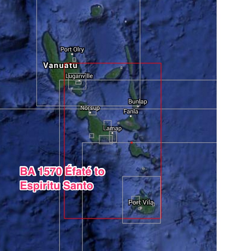
Another alternative is to take a route which goes through Grand Passage, north of New Caledonia, as described in route P894. On that route, a better wind angle may make it possible to stay on the starboard tack NE of Grand Passage and sail to Espiritu Santo Island, where it is possible to clear into Vanuatu at Luganville (15“31‘8, 167°10‘E).

Queensland to Fiji


Because of both contrary winds and current sailing a direct route from Queensland to Fiji would be a very difficult undertaking. The most feasible way to reach Fiji is by a detour to the south Where better winds might be found to make the required easting (route PS104A). Although the recommended tactic is to sail south of latitude 32“S, where the chances of finding favourable winds are higher, a slightly more northerly route can be taken should the winds permit this. Ideally one should wait for a forecast of westerly winds before leaving. Even with favourable winds, the route should remain south of the latitude of Norfolk Island until past that island. It consistent headwinds are met while in the vicinity of Norfolk, a stop can be made there. The anchorage at Kingston (29"01'8, 167 “59‘E) is not considered safe and should be left if the weather threatens to deteriorate.

Preferably one of the ports in South Queensland should be taken as a departure port. From WP PS1041, off Stradbroke Island, the initial course goes to WP PS1042, south of Norfolk Island. From there, the course should start curving NE. If a direct course can be sailed from WP PS1042 to Fiji, attention must be paid to Theva-i-ra Reef, also known as Conway Reef (21°44'S, 174°38'E), which will be passed closely. Having made landfall off Navula Passage, at WP PS1045, that pass will be taken through the reef into Nadi Waters and on to Lautoka to complete entry formalities into Fiji.

Depending on weather conditions and the windward performance of the boat in question, a more direct route (PS1041B) passing close to New Caledonia may be sailed. Although shorter, such a route may not be necessarily easier as there is a higher chance of encountering contrary winds on the subsequent leg between New Caledonia and Fiji. From WP PS104l, an initial course will be sailed to WPs PS1043 and PS1044, SE of the main island of New Caledonia. From there, the route passes close to a number of dangers south of Durand Reef, before a course can be set for WP PS1045, if the intention is to make for Lautoka. The alternative, if the necessary easting can be made, is to head for Suva, in which case landfall should be made at WP PS1046, north of Vatulele Island.

From that point, the Fijian capital will be reached through Beqa Channel, separating the island of that
name from Viti Levu. Daveta Passage leads into Suva Harbour where arriving boats should go to the quarantine anchorage and wait to be cleared.

Routes from Tonga

Tonga to Fiji


This passage between the two neighbouring island groups can be made at any time of the year, although the cyclone season should be avoided, especially the period January to March when both the islands and the waters between them are crossed by cyclones. During July and August, when the SE Trade Winds are at their strongest, the passage can be rough. At the beginning and end of the winter season the winds are lighter, but the sky is often overcast which can make navigation through these dangerous waters quite difficult.

Because of the risks involved in passing through Fiji’s Lau Group, boats leaving from Vava’u should avoid the more direct Oneata Passage and sail instead through the wider passage between Ongea Levu and Vatua islands (route PS47C). The latter passage is also used by boats leaving from Tongatapu. If using Oneata Passage, one should be aware of the dangers of sailing at night through the area west of Oneata, where none of the islands have lights. For similar reasons, Lakemba Passage should also be used with great caution.


The southern passage, between Vatua and Ongea Levu, is marked by lights both on Vatua Island and the southern extremity of Totoya  Island and is therefore the easiest to use. Having left Tongatapu through Egeria Channel (route PS47A), from WP PS471 a course is set for WP PS472, 10 miles due north of the light on Vatua. From there the course is altered for WP PS473, approximately 5 miles south of Totoya. From that point a direct course can be set for WP PS474, one mile east of Balavu Reef, at the southern entrance into Levuka, on the island of Ovalau, an official port of entry into Fiji.

Boats bound for Suva direct (route PS47B), from WP P8473, south of Totoya Island, should set a course for WP PS475, in the approaches to Suva. For the last few miles, the course runs parallel to the reef as far as WP P8476, at the entrance into Daveta Levu Passage, which leads into Suva Harbour. The approaches are well buoyed and lit and there are clear range markers making it easy to enter this harbour even at night if necessary. Arriving boats should go straight to the quarantine anchorage and wait to be cleared by a health officer. After that they can proceed to King’s Wharf to complete the rest of the entry formalities.

Boats leaving from Vava’u and using the same southern passage (PS47C), from WP P5477, outside Faihava Passage, should set an initial course for WP PS478, to pass north of Late Island. From there the course should be altered for WP PS472, north of Vatua Island, and subsequently the same direction can be followed to pass through the recommended waypoints and clear in at either Levuka or Suva. The route from Ha’apai to Fiji passes very close to Metis Shoal (19°11 .4‘S, 174°51'W), where an active volcano is erupting and has created a cone standing at least 50 m (150 ft) above sea level. Although spectacular, the area should be approached with caution.

Route PS47D offers the option of approaching the Fijian islands from the NE by using the Nanuku
Passage. WP PS479 is about 5 miles east of Welangilala light, which marks the eastern side of the pass. This side of the wide pass should be favoured because the southern extremity of the extensive Nanuku Reef, which lies on the NW side of the passage, is not marked by a light. Great care should be exercised when approaching Nanuku Passage because of the strong currents and the reports that Welangilala light is occasionally not operational. The nearest port of entry is at Savusavu, on the south coast of Vanua Levu. Contact Copra Shed Marina on channel 16.


Stopping and going ashore anywhere in Fiji before clearing in first at one of the ports of entry is strictly prohibited. Special permission is necessary to cruise in the Lau Group and must be obtained in Suva.

Warning: Although the dateline will be crossed on this passage, the official date in Tonga is the same as in Fiji.

Routes from Fiji


Fiji to New Cal


During the SE trade wind season, winds along this route are mostly fair and there is also a favourable
current. Boats leaving from Suva should keep close to the south coast of Viti Levu and go through the
Mbengga Channel to avoid the reefs surrounding the island of that name (Beqa or Mbengga). Having passed Vatulele Island, from WP PS541 a course can be set for the NE extremity of New Caledonia Island if the intention is to sail direct to Noumea. If leaving from Lautoka it is best to reach the open sea through Malolo Passage before setting a course for New Caledonia from WP PS542. A direct course leads to WP PS543, in the approaches to Havannah Pass. This pass should be negotiated on a flood tide. Due to the prevailing SE winds the tide sets very strongly through the pass creating large waves when the ebb tide runs against a strong wind. Because of the large landmass, the SE winds become southerly as they are deflected around the main island of New Caledonia.

Noumea is New Caledonia’s only port of entry and all boats must clear in there. Approaches into Noumea are difficult at night and should not be attempted. If coming from either Boulari or Havannah Pass, and Noumea cannot be reached in daylight it is recommended to anchor for the night
and enter the port the following morning. Noumea Harbour is entered through Petite Passe. Arriving
boats should contact Port Moselle on channel 67 to arrange a berth at the visitor’s dock. The marina
Will contact customs and immigration for clearance. Although New Caledonia is a French overseas territory, a bond is not required from cruising boats as in the case of French Polynesia.

Fiji to Vanuatu


The route leaving from Suva follows the south coast of Viti Levu closely to avoid the reefs surrounding Mbengga (Beqa) Island. North of Vatulele Island, at WP PS551 a course can be set for the southern extremity of Efate Island. Boats leaving from Lautoka will find it easier to reach the open sea through the Malolo Pass and set course for Vanuatu from WP PS552. Alternatively, one can sail due west from Lautoka and thread one’s way through the islands and reefs of the Mamanuca Islands. The open sea is then reached through one of the many passes in the Mamanuca Reefs.

A direct course can be set for WP PS553, SE of Efate. From there the route stays parallel to the south coast of Efate to Pango Point before turning into Mele Bay and finally into Port Vila Bay.

Favourable winds can be expected on this route during the SE trade Wind season. The currents in this area set to the SW and this should be allowed for. The visibility in the Vicinity of Efate is sometimes very poor and, although a high island, it can remain obscured until close to land. A regular feature of this route is the annual Musket Cove to Vila Race, a fun event joined by most cruising boats planning to sail west during that period (September). The race leaves from Musket Cove on Malololailai Island.

Port Vila is one of two official ports of entry into Vanuatu. The other one is Luganville, on Espiritu Santo Island (15°31'S, 167“10'E). On arrival at Port Vila, boats should tie up to the quarantine buoy and wait to be cleared. Port Vila Radio should be contacted on VHF channel 16 to request that the relevant officials are informed. Those who intend to spend the cyclone season in Port Vila must make
arrangements to have their boats hauled out as the authorities do not allow cruising boats to stay in the water from December until March.